Survey of Asby Scar
Surveying on the limestone pavement June 2014

Rectangular feature which is probably combined quarrying and building/shelter with some remaining elements of walls.

Boundary marker or coup stone (broken but reassembled)
OK, so the weather forecast was grim, but 4 hardy souls went out onto Asby Common to do a bit of surveying. And we had a fabulous time, recording upright (boundary?) stones and cairns and anything else we could find. We were so busy chasing 100m of relict wall and bank (possibly prehistoric) across the limestone pavement that we barely noticed the first shower. Then Tom spied another bit of wall just over there, so we gathered ourselves and headed off. Stones piled on top of the natural rock along both sides of a wide grike (gap between the limestone slabs), and along one end to form a shelter. And at the far end a beautiful little square enclosure on one side, the whole thing facing out onto a wide track. A summer “house” with animal enclosure? A holiday house with granny annexe/conservatory? Who knows. We thought it was fabulous. And then the real beauty. A sub-circular structure, again next to a track, partly built up with rock piled onto the limestone, partly an earth bank a couple of feet high. At 20 m across at its widest point it’s a significant structure, and right on the edge of the limestone, with wide grassy expanse in front. A possible entrance – and what a view! I could live there. We decided it was a tea shop and stopped for lunch. And then it really did rain and despite the excitement we noticed that we were getting quite wet. Still, as we headed in a very round about sort of homeward direction we carried on getting diverted to stones and cairns, until the limestone got seriously slippery. Time to get to the grass and walk down in safety. But a good day, and thanks to Judith, Bob and Tom for coming with me and staying enthusiastic even when the weather turned really nasty! But look on the bright side, we didn’t get the thunderstorms.

Sub circular feature – possibly a stock compound
The remains of a wall that extended quite some distance
Jan Hicks
Photos by Bob Abram
June 21st – Surveying on Asby Scar..…Episode 2
More surveying on the limestone pavement……..

Enclosure with standing stones

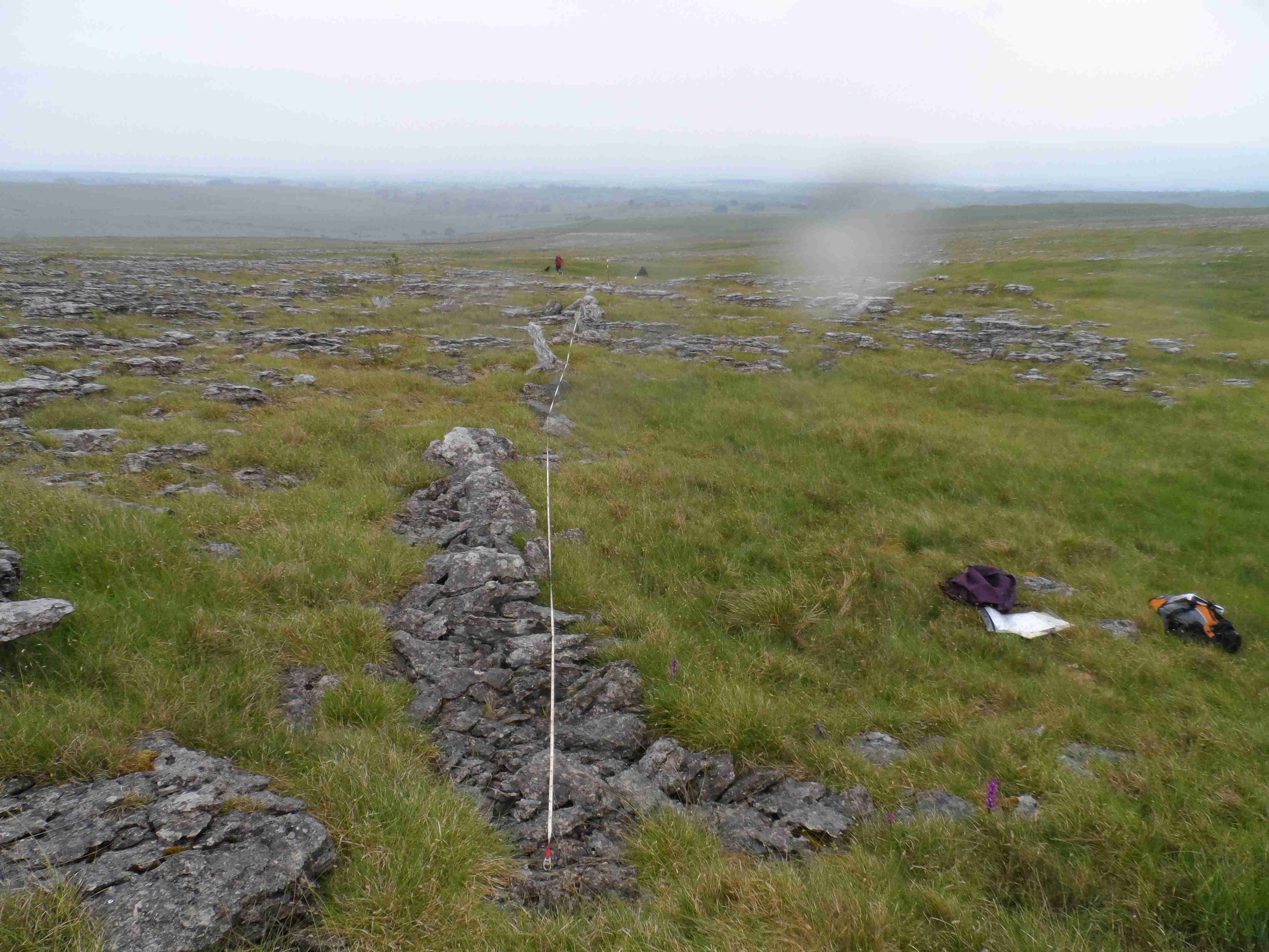
Jan’s wall. Need more tapes!

Jan recording
2 weeks after the 4 intrepid explorers braved the weather to survey stone features on Asby Scar, the weather forecast looked a bit more promising. So Jan put the call out for anyone who might be available for a bit of follow-up work. In the end summer absences meant that it was only Jan and myself (the newest LAS member) who could make it. So serious consideration was given to boosting numbers by bringing Jan’s dogs along too, but this was reluctantly rejected due to the possibility that their attention to accurate recording might just be compromised by the alternative attractions of rabbits or frisbees. So in the end it was just Jan and me who climbed the footpath through the fields in gloriously clear and sunny weather, dodging curious sheep and admiring the wild flowers and landscapes as we went.
Jan had a new GPS device to try out, so once onto the limestone pavement, Plan A was to revisit features identified 2 weeks before and get their details recorded. At this point a new discovery was made. The GPS device actually needed 2 hands, one to hold it, the other to operate it (and a user manual might have been useful too), so other equipment had to be put down and ideally not forgotten about and lost in the long grass ! But these challenges were overcome, and bit by bit we began to re-find and measure features. At which point Plan B kicked in, i.e. oh look there’s something interesting, let’s go have a see ! And so the pattern for the day was set, we followed up anything and everything we could see, recorded the location, checked whether it was a feature found previously, and took measurements (and when I say ”we” it was really Jan who sped around and did it all, I just took the photos !).
So what did we find (apart from occasional fragments of shell casings from when the area was used as a firing range) ? There were cairns as far as the eye could see (possibly located so the next one was always in view ?), there were possible remains of enclosures often butting up against the pavement slabs, and more of the small “standing stones” maybe used to mark boundaries or for some other mysterious purpose (like the ones on the squarish slab feature near where we stopped for lunch). And there was Jan’s “special one”, the remains of an amazingly long wall !
And as the “newcomer”, what did I learn ? First, what a beautiful area it is, and when it’s clear just how far you can see in all directions. Second, grikes come in many sizes and depths, many with wild flowers growing wherever they can cling on, others just lying in wait for the unwary or uninitiated (like me) to trip into or worse ! Third, watch out for the sink holes ! And fourth, the same feature may look very different or even be totally invisible depending on where you’re looking from…….so keep looking round, there’s always something new !
Finally, many thanks to Jan for organising the day, being so hospitable, and not least being so patient when my less-than-gazelle-like agility slowed us down !

Cairn

Remains of possible stock enclosure
Steve
Photos and article: Steve King June 2014
The survey of Great Asby Scar continued until 2021 as part of the Westmorland Dales project, with LAS contributing a large number of days to the survey of the limesotne pavement area in particular. The full report is available for download here: summary_report great Asby
